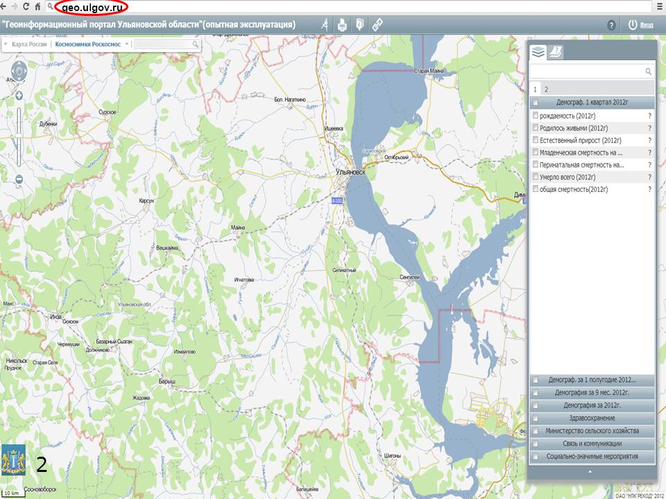
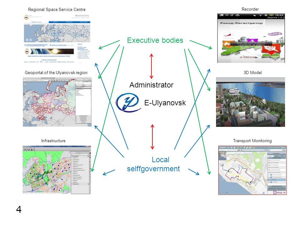
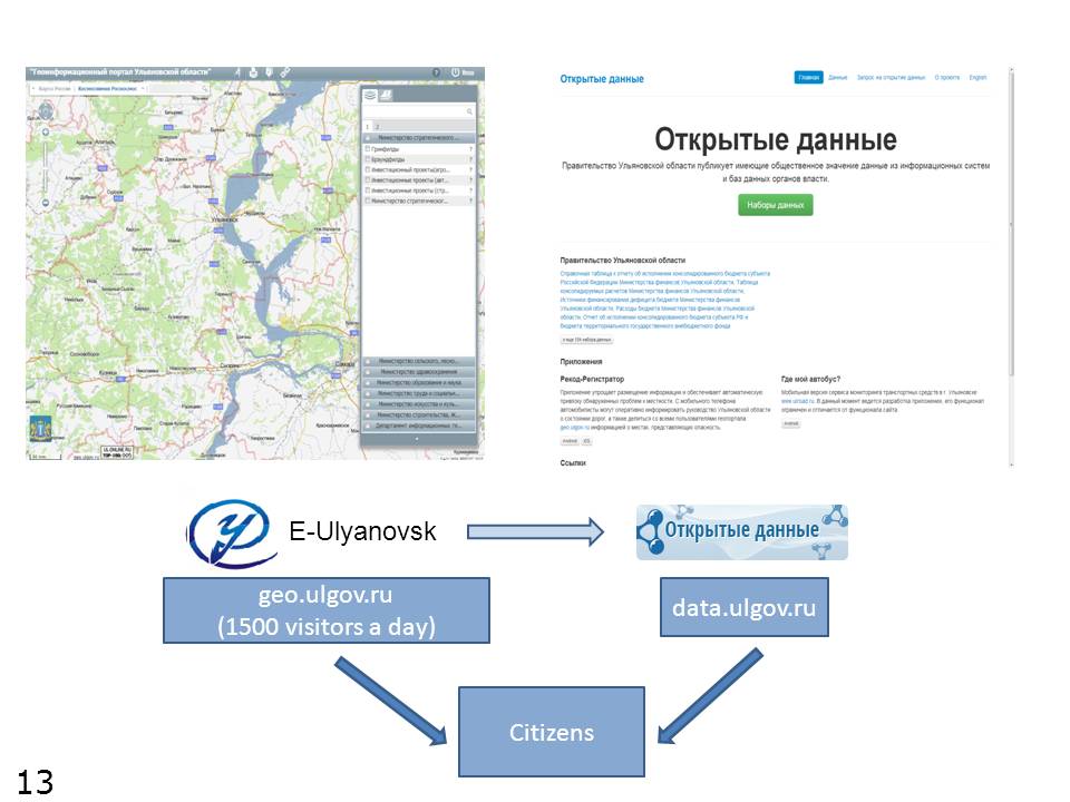
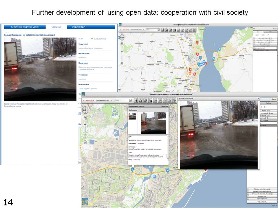
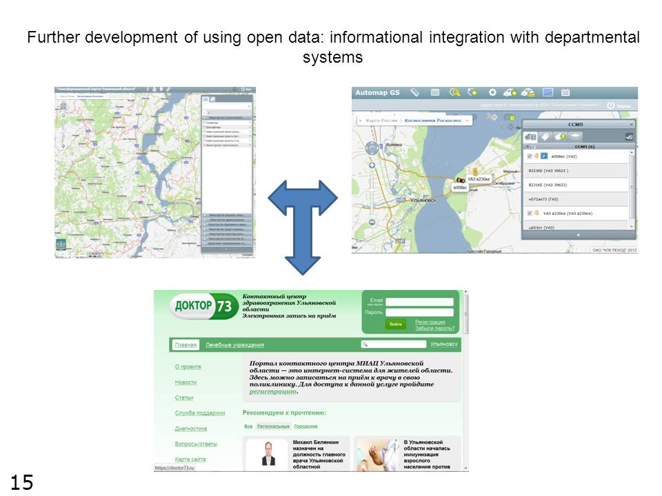
Information system "Geographic portal of the Ulyanovsk Region"
 The system
provides the whole technological process of cartography: data collection,
representation, publication, printing and making reports. The navigation and
tracking system is integrated with GPS and provides continuous movement control
of various objects, displaying it on the edited map. The single database of the
geographic information system database provides fast data exchange between
departments and easy access to any requested information. All data are ready-to-use
which allows the user not to waste any time on routine processing. The reports
are presented both in the classical text form and as charts, tables and
graphics (possible to be attached to certain people). Besides this the program
allows to create thematic reports according to the parameters set by user.
The system
provides the whole technological process of cartography: data collection,
representation, publication, printing and making reports. The navigation and
tracking system is integrated with GPS and provides continuous movement control
of various objects, displaying it on the edited map. The single database of the
geographic information system database provides fast data exchange between
departments and easy access to any requested information. All data are ready-to-use
which allows the user not to waste any time on routine processing. The reports
are presented both in the classical text form and as charts, tables and
graphics (possible to be attached to certain people). Besides this the program
allows to create thematic reports according to the parameters set by user.
Here you can find the presentation about GeoPortal


УльяновскДома.РФ - Цифровое сопротивление COVID-19

Postal Address: Goncharova street 11, Ulyanovsk, Russian Federation, 432017
Phone: 37-13-13 (ext.1071) E-mail: wego.ulregion@mail.ru